| Title | Quicklook | Description | Place | Time Period of Content | Download |
|---|---|---|---|---|---|
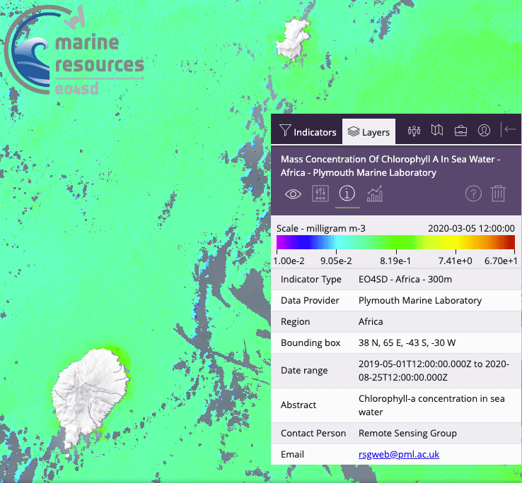
| Water quality for large geographical regions |
 (238 KB) |
Example of a Chl-a map for São Tomé & Príncipe | São Tomé & Príncipe | March 05, 2020 | Example in GIS portal Portuguese User Guide (PDF, 5.5MB) |
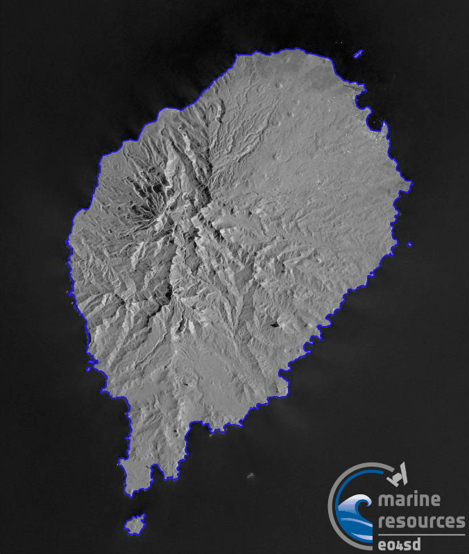
| São Tomé 2019 Shoreline |
 (212 KB) |
Shoreline shapefile was created by temporaly stacking 38 Sentinel-1 SAR images from 2019 then applying statistical edge detection using enhanced Region of Averages method. | São Tomé | 20190101 - 20191230 | Shapefile
(ZIP, 86.3 KB) Metadata (XML, 3.2 KB) |
| Principe 2019 Shoreline | 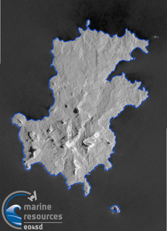 (220 KB) |
Shoreline shapefile was created by temporaly stacking 68 Sentinel-1 SAR images from 2019 then applying statistical edge detection using enhanced Region of Averages method. | Principe | 20190101 - 20191230 | Shapefile
(ZIP, 86.3 KB) Metadata (XML, 3.2 KB) |
| São Tomé Historical Shorelines |
 (230 KB) |
Version 1 - Unvalidated shorelines from Sentinel imageryThis layer consists of data used to map shoreline change rates in Sao Tome produced by the National Oceanography Centre for the Marine and Coastal Resources project under the initiative Earth Observation for Sustainable Development (EO4SD) by the European Space Agency. Geodatabase contains: Shorelines from 2019 and 2020 can be visualised, created by annual median composites of Sentinel 2 imagery which delineates the approximate mean high water mark. Methods are inspired by Coastsat, a Google Earth Engine-enabled open-source software toolkit that delineates shorelines at any sandy coastline worldwide from over 30 years of publicly available satellite imagery (https://github.com/kvos/CoastSat). |
São Tomé | 2019 - 2020 |
Shapefiles (ZIP, 405 KB) GDB file (ZIP, 207.5 KB) Metadata (XML, 5.7 KB) |
| São Tomé 2019-2020 Bathymetry |
 (151 KB) |
Bathymetry mapping using Sentinel-2 images from 2019 and 2020 (no usable data due to high cloud coverage is available from earlier years) and comparison results with in situ data which is gathered during fieldwork in December 2018. | São Tomé | 20191211 - 20191230 | Grey scale TIFF raster file (ZIP, 5 MB) Metadata (XML, 3.2 KB) |
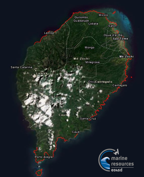
| Landcover Map of São Tomé (2020) |  (189 KB) |
São Tomé land cover classification data (2020) produced by Brockmann Consult GmbH for the Marine and Coastal Resources project. |
São Tomé | 2020 |
Raster file (ZIP, 344 KB) Metadata (XML, 5 KB) |