| Title | Quicklook | Description | Place | Time Period of Content | Download |
|---|---|---|---|---|---|
| Water quality for large geographical regions | TBD | Complete Region | TBD | GIS portal User Guide (PDF, 2.1MB) |
|
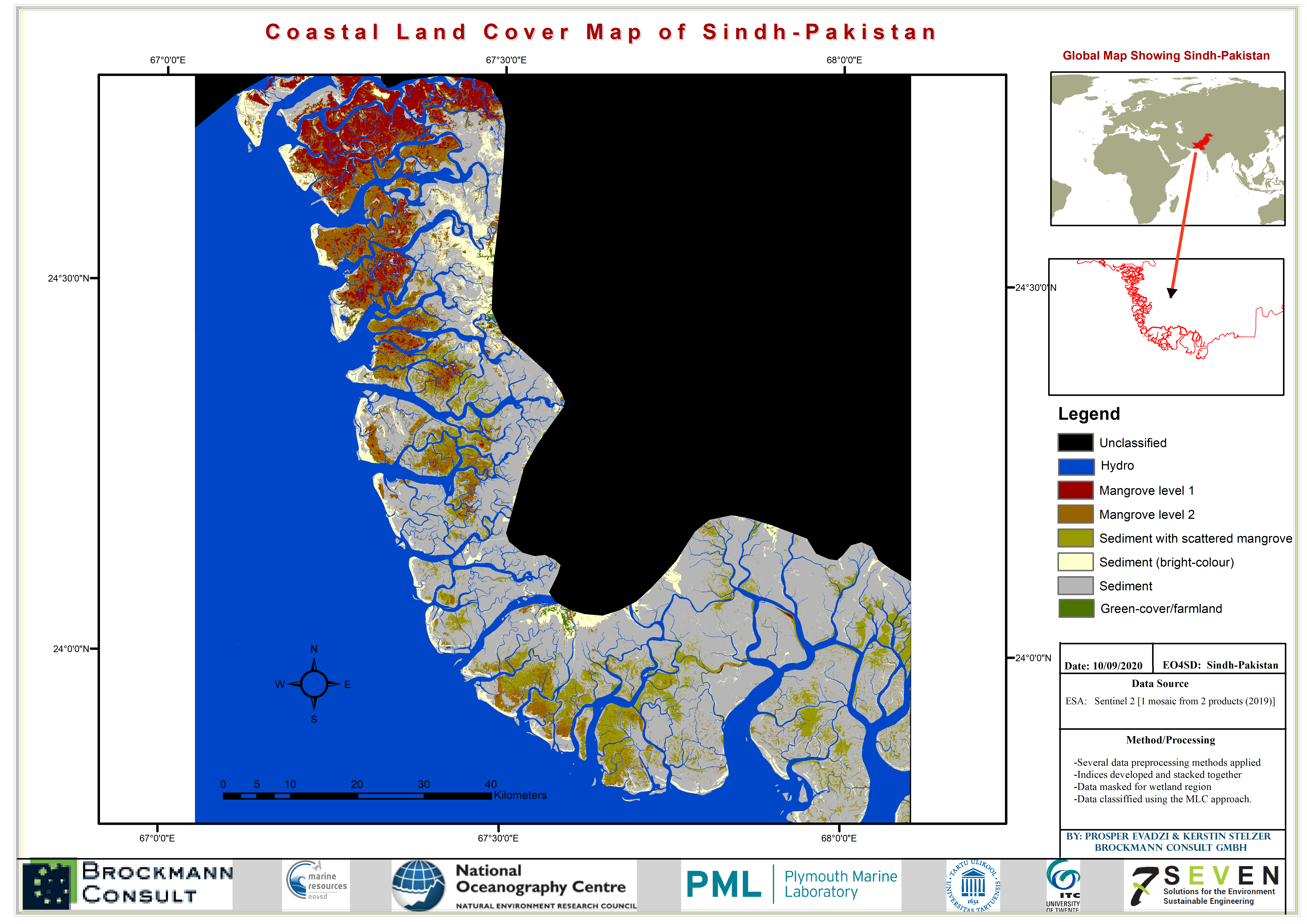
| Sindh-Pakistan Coastal Landcover (2019) |
 (1 MB) |
This is the Sindh-Pakistan land-cover classification data (2019) produced by Brockmann Consult GmbH for the Marine and Coastal Resources project.This is under the initiative Earth Observation for Sustainable Development (EO4SD) by the European Space Agency. This raster file is generated from sentinel-1 (14 products; 2019), 1 mosaic Sentinel-2 (2 products; 2019). The supervised classification method used is the Maximum Likelihood Classification (MLC). The land-cover sample data (training areas) used were desktop-generated with support from high-resolution Google-Earth images. |
Sindh-Pakistan | 2019 | GIS data (TIF, 132.9 MB) Metadata (XML, 3.8KB) |