| Title | Quicklook | Description | Place | Time Period of Content | Download |
|---|---|---|---|---|---|
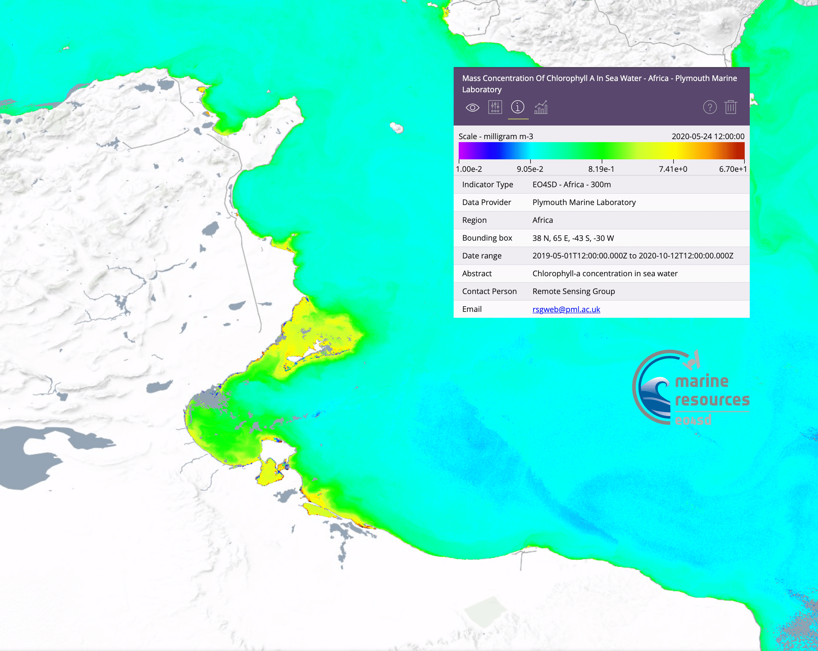
| Water quality for large geographical regions |
 (2.1 MB) |
Example of a Chl-a map for North Africa | Tunisia/Libya Gulf Of Gabes |
May 24, 2020 | Example in GIS portal User Guide (PDF, 2.1MB) |
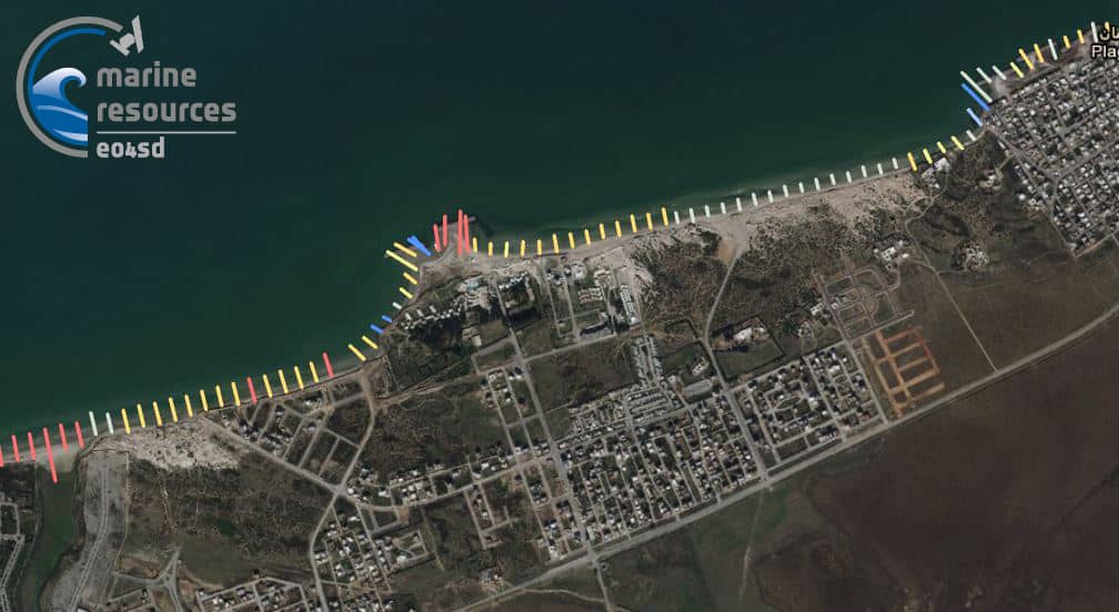
| Shoreline Change Tunisia 2000-2020 (Transects at 50m intervals) |
 (55 KB) |
Shoreline Change Transects which include erosion rates based on optcial satellite delineated shorelines.Based on Landsat 7, 8 and Sentinel 2 data from 2000-2020 in the month of May. Transects are 50m intervals along the Tunisia shoreline and are based on a wieghted linear regression. Dataset is provided as vector datatset within a geodatabase. |
Tunisia | 2000 - 2020 |
GDB file (ZIP, 28.6 KB) Metadata (XML, 5.1KB) |