| Title | Quicklook | Description | Place | Time Period of Content | Download |
|---|---|---|---|---|---|
| Water quality for large geographical regions | 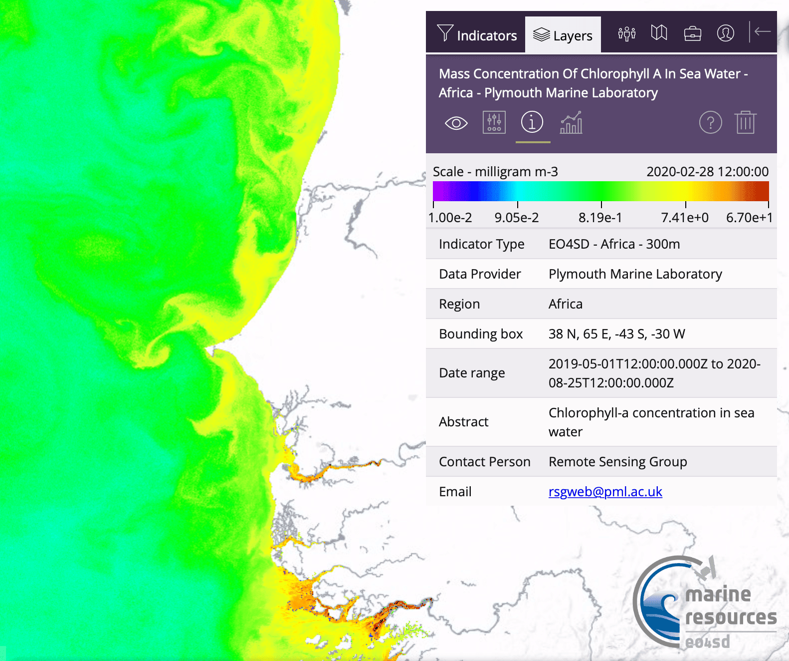 (535 KB) |
Example of a Chl-a map for West Africa | Mauritania/Senegal Atlantic Ocean |
Feb. 28, 2020 | Example
in GIS portal User Guide (PDF, 2.1 MB) |
| Mauritania Historical Shorelines, Shoreline Change Rates (2000-2020) and 10- and 20-year forecast - Version 1 | 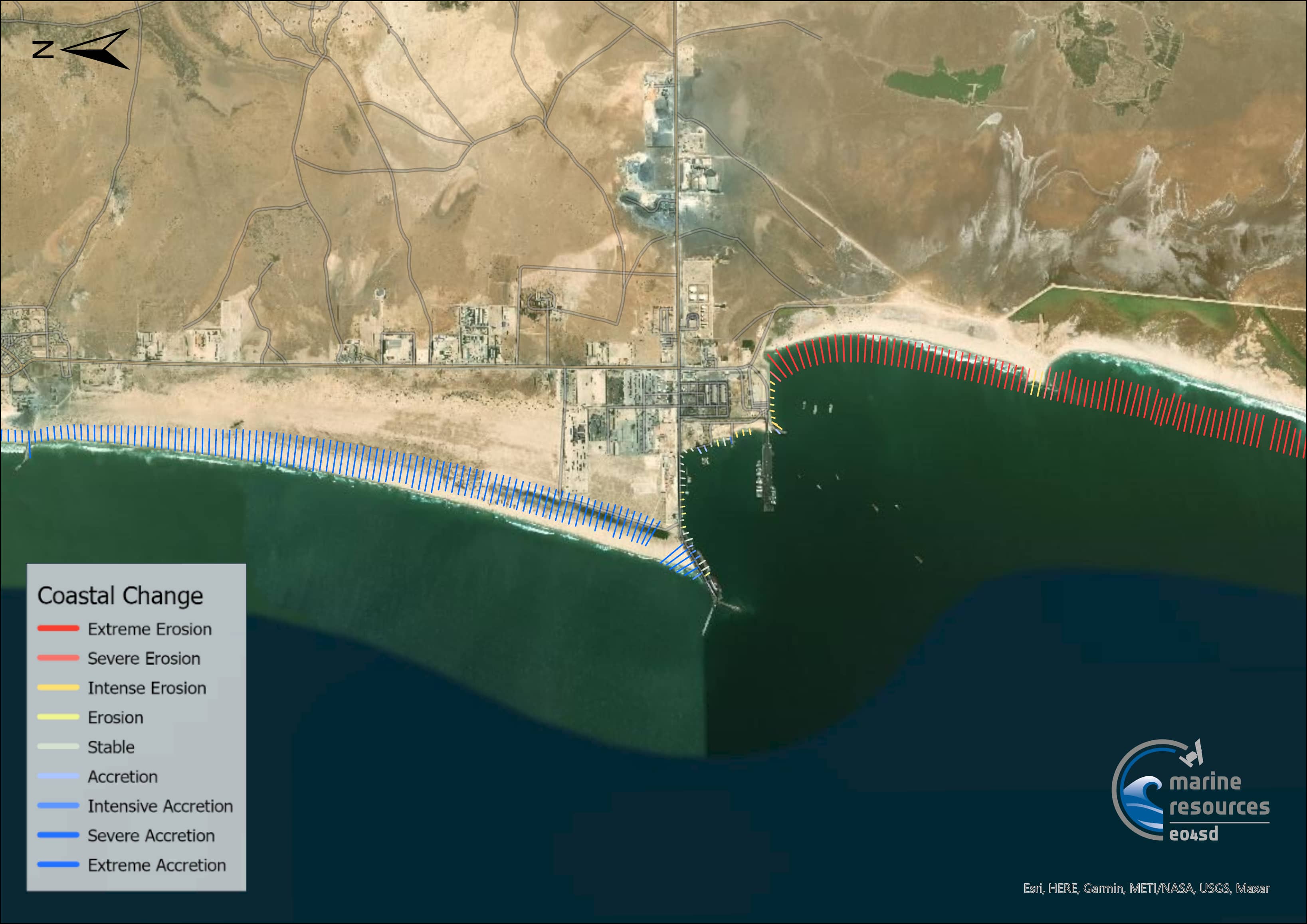 (369 KB) |
Version 1 - Unvalidated and occasional mis co-registration between shorelines from Landsat and Sentinel imagery which can skew change rates.This layer consists of data used to map shoreline change rates in Mauritania produced by the National Oceanopgrahy Centre for the Marine and Coastal Resources project under the initiative Earth Observation for Sustainable Development (EO4SD) by the European Space Agency. Geodatabase contains: Admin boundary - administrative boundary of coastline Mauritania Shorelines - Each shoreline delineated from the 20-year period Forecast 10 [years] Forecast 20 [years] Forecast Uncertainty 10 [years] Forecast Uncertainty 20 [years] Shoreline change rates - transects Historical shorelines between 2000-2020 can be visualised, created by annual median composites of Landat 7, 8 and Sentinel 2 imagery which delineates the approximate mean high water mark. Methods are inspired by Coastsat, a Google Earth Engine-enabled open-source software toolkit that delineates shorelines at any sandy coastline worldwide from over 30 years of publicly available satellite imagery (https://github.com/kvos/CoastSat). |
Mauritania | 2000 - 2020 |
Shapefiles (ZIP, 30.6 MB) GDB file (ZIP, 15.4 MB) Metadata (XML, 7.9 KB) |