| Title | Quicklook | Description | Place | Time Period of Content | Download |
|---|---|---|---|---|---|
| Water quality for large geographical regions | 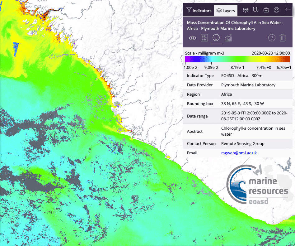 (300 kB) |
Example of a Chl-a map for West Africa | Guinee/Sierra Leone/Liberia Atlantic Ocean |
March 28, 2020 | Example
in GIS portal User Guide (PDF, 2.1 MB) |
| EO4SD Liberia v1 finfish mean stock density |
 (37 KB) |
Map of finfish mean stock density in Liberia coastal region. | Liberia | 20191022 - 20200131 | Data file (NetCDF, 9.2MB) GIS data (TIFF, 9.2MB) Metadata (XML, 2.6KB) |
| EO4SD Liberia v1 finfish site selection |
 (33 KB) |
Map of finfish site selection in Liberia coastal region. | Liberia | 20191022 - 20200131 |
Data file (NetCDF, 9.2MB) GIS data (TIFF, 9.2MB) Sample data (*.kml) Metadata (XML, 2.6KB) |
| Liberia, Oil Spill Detection Service | 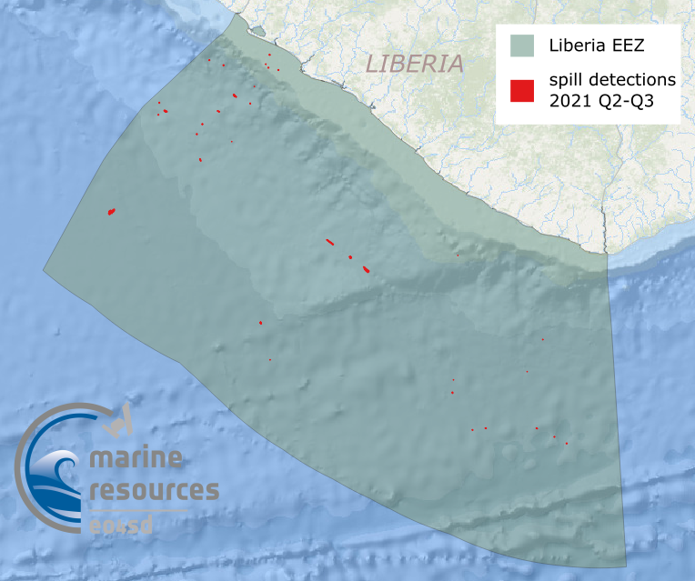 (436 KB) |
Oil Spill Detection maps include oil spill vector data and the backscatter coefficient SAR images of Liberia. The data are provided in Google Maps KML format. | Liberia | Apr-Sept 2021 |
Full oil spill dataset available on request (liat@pml.ac.uk) here Sample data (*.kml) Metadata (XML, 4KB) |